
Sewer Inspection & Video Pipe Assessment
CCTV sewer inspection, manhole inspection and lateral inspection with multi-sensor measurement, laser profiling and sonar. 4K capture with the geometry recorded alongside it, so what comes back is a measured condition record rather than footage somebody still has to interpret.
Multi-Sensor Inspection — geometry, not estimates
Defect coding tells you what is wrong. Measurement tells you by how much. Three sensor packages run alongside the camera and return numbers you can put in a specification rather than an impression somebody formed watching a screen.
Time-of-Flight ovality
Integrated into the robot's camera head — no separate trip, no add-on tractor.
Dual laser
Quick-attach add-on for joint and material-loss measurement where tolerances matter.
Laser profiling
Full-bore geometry on the traction platform, for lines where deformation is the question rather than a defect code.
The laser runs on the same pass as the camera.
A projected laser ring gives the bore its true shape at every foot of the run — ovality, deformation and section loss as numbers a rehabilitation can be designed against. It is captured alongside the video, not as a separate mobilization with a separate invoice.
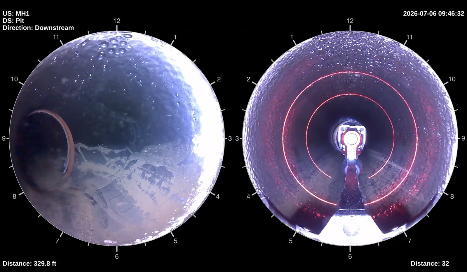
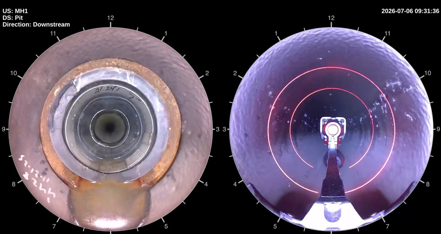
Screen captures from our own inspection runs. Asset identifiers are the client’s own node numbering; no site or owner detail is shown.
Sonar, for the half of the pipe a camera cannot see.
A camera stops at the waterline. In a surcharged or partially full line everything beneath it — silt depth, debris shelves, the bore that is actually left — is invisible to CCTV. That is how a main gets reported as flowing right up until the morning it is not.
Sonar profiles that lower half and returns it as measured cross-section rather than inference. Run alongside CCTV above the waterline, it produces a full-bore record of a line nobody could take out of service.
We bring sonar in for the scopes that call for it rather than carrying it as owned equipment. It is specified and priced per project. Tell us a line is surcharged and we will quote it with sonar instead of sending a camera that cannot answer the question.
Scopes that need sonar
- Surcharged or partially full mains that cannot be dewatered or taken down
- Silt and debris depth quantified before a cleaning scope is priced
- Remaining bore established in a line carrying heavy sediment
- Trunk mains and interceptors where bypass pumping is impractical
- Paired with CCTV above the waterline for a complete cross-section
Brought in per scope, not owned equipment — and we say so in the proposal rather than letting you find out later.
A forty-pound system that goes where a CCTV truck cannot.
Our primary mainline platform is carried to the manhole by two people — which is the whole reason it reaches easements, back lots, hillsides and secured sites that quietly never get inspected because staging a truck there is impossible. 4K video, 360° views, inch-level positioning and LTE/5G, so the client can watch the run from an office.
- 40 lb complete system — carried in, not driven in
- 6" to 48" pipe capability, 2,000 ft reach
- 4K video with low-latency live streaming
- 360° views for post-run review at any angle
- Inch-level precision positioning
- Data uploads from the site, not off a hard drive days later
Forward view, reverse view and the laser, on the same pass.
The system records forward and reverse 360° views simultaneously, with the laser profiler projecting on the same run. Nothing has to be re-inspected to pick up a second data type, and nothing gets missed because the camera happened to be pointing the wrong way going past a connection.
In practice that is the difference between one mobilization and three: the condition video, the coded observations and the measured geometry all come off a single deployment, on assets a truck-based crew would have had to skip.
What the mainline platform actually is.
We publish the operating envelope because specifying engineers need it to write a scope. Manufacturer and model detail sits in the capability statement, which we send the same day it is asked for.
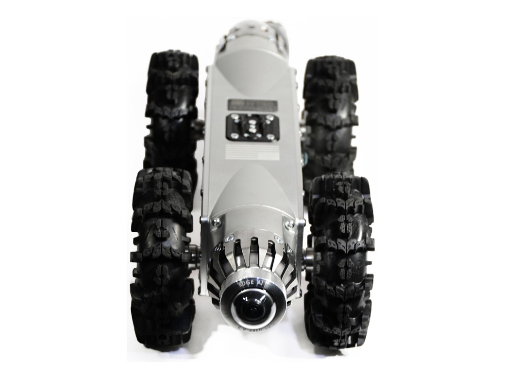
Mainline inspection platform
The inspection starts at the structure, not at the truck.
A man-portable system is carried to the manhole, the cleanout or the roof stack. There is no need for the camera truck to be able to park on top of the asset, which is the single most common reason a segment gets skipped in a network-wide inspection program and shows up in the next report as “not surveyed”.
That matters most on the assets that are hardest to schedule: easements behind buildings, secured sites, hillside runs, and laterals that only open from inside an occupied unit.
Every observation we return is coded by a NASSCO-certified operator against the program the asset calls for — PACP on the main, MACP on the structure, LACP and BSDI on the lateral and the building side.
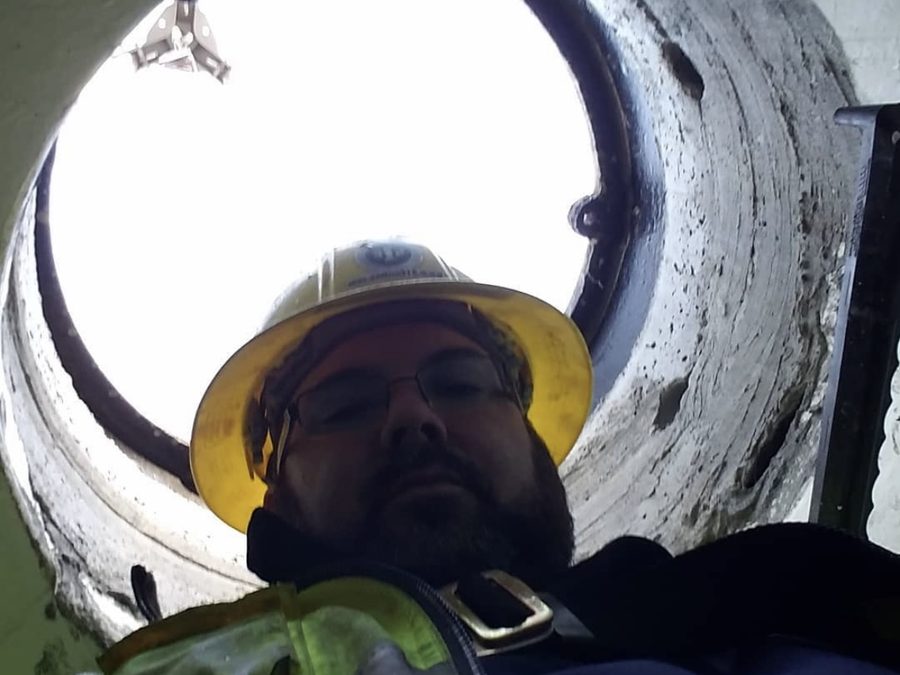
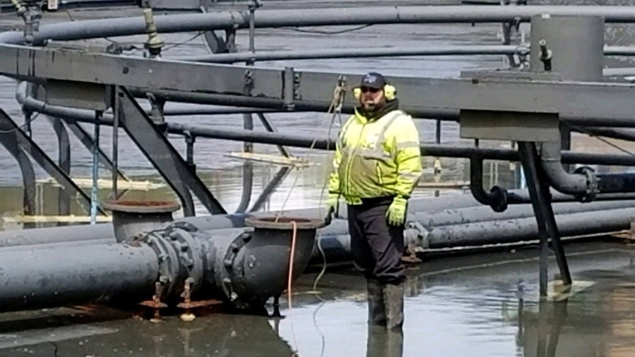
The robot works the channel while the crew stays on the surface.
Launched through the cover and tracked into the channel — no entry, no permit, no standby crew. The benching and the inverts get looked at on the way through rather than guessed at from the rim.
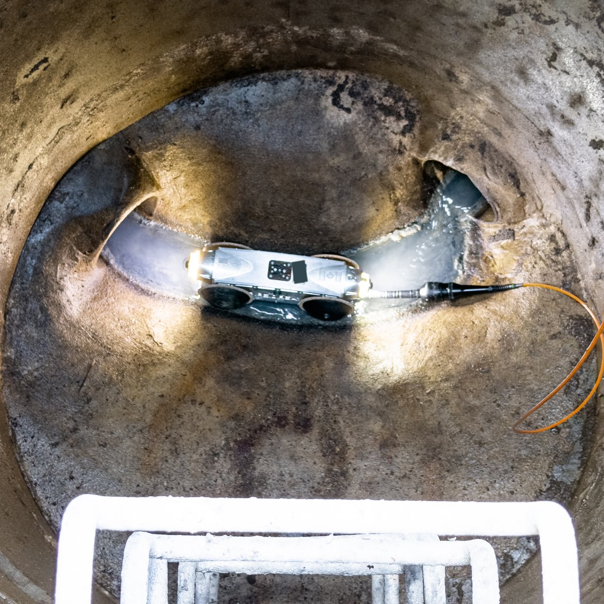
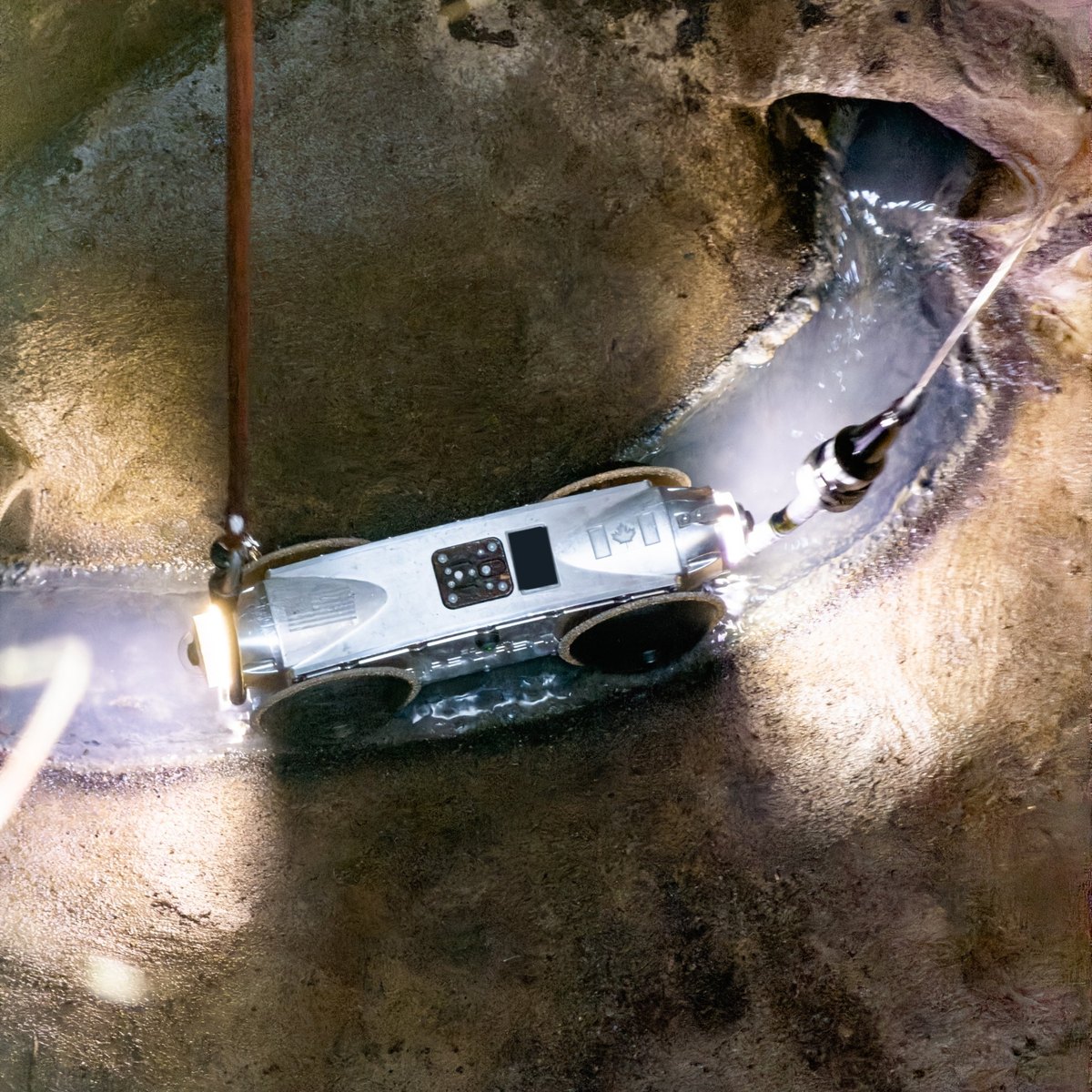
Project photography from work performed by our crews and by our leadership’s prior companies. Client-identifying detail removed.
How much wall is actually left?
A condition code tells you what the pipe looks like. It does not tell you how much steel or concrete is still there. Our traction platform measures remaining wall thickness from inside the pipe, in place — the number that decides repair against replacement, and the one most integrity programs are missing.
Repair or replace, on evidence
Visual condition and remaining wall often disagree. A line that looks bad can have plenty of wall left; a line that looks acceptable can be close to perforation. Measuring removes the guess from a capital decision.
Industrial and process pipe
Refinery and plant process lines, cooling water, intakes and outfalls, penstocks and force mains — anywhere a wall-loss rate drives an inspection interval and a shutdown schedule.
Same mobilization as the clean
Deposit has to come off before anything can be measured through it. The same robot cleans the surface, gauges the wall and can coat it before it leaves — one entry, one tether, one crew.
Measurement coverage, resolution and reporting format depend on substrate and scope. Tell us the material and the line and we will say what the data will look like before you commit to it.
The route is recorded on the same pass as the condition.
Our push cameras map the pipe as the head travels — XYZ coordinates, depth and alignment for laterals, service lines and vertical stacks, built as a site plan in real time. It runs alongside the inspection rather than as a separate mobilization, so the condition record and the route come off one deployment. See 3D pipe mapping →
Capture it once, measure it at the same time.
Tell us the diameter, the access and whether the line runs full. We will tell you which sensors the scope actually needs.